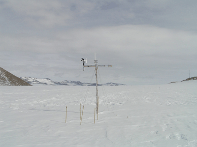
Automatic Weather Stations - 2022
| Regions:Years: |
Queen Maud Land Stations (2022): |
|
Utsteinen AWSOwner:Site Code: UTS Initial Start Date: Installed: 2011-01-01 Latitude: -71.95 S Longitude: 23.35 E Elevation: 1,392 meters AWS Model: UU/IMAU Notes: Distance from the coast: 173 km UU/IMAU AWS (Utrecht University/Institute for Marine and Atmospheric Research Utrecht, The Netherlands) References of AWS applications: Gorodetskaya, I. V., M. Tsukernik, K. Claes, M. F. Ralph, W. D. Neff, and N. P. M. Van Lipzig (2014), The role of atmospheric rivers in anomalous snow accumulation in East Antarctica, Geophys. Res. Lett., 41, 6199–6206, doi:10.1002/2014GL060881. Gorodetskaya, I. V., Kneifel, S., Maahn, M., Van Tricht, K., Schween, J. H., Crewell, S., and Van Lipzig, N. P. M.: Cloud and precipitation properties from ground-based remote sensing instruments in East Antarctica, The Cryosphere Discuss., 8, 4195-4241, doi:10.5194/tcd-8-4195-2014, 2014. Gorodetskaya, I. V., N. P. M. Van Lipzig, M. R. Van den Broeke, A. Mangold, W. Boot, and C. H. Reijmer (2013), Meteorological regimes and accumulation patterns at Utsteinen, Dronning Maud Land, East Antarctica: Analysis of two contrasting years, J. Geophys. Res. Atmos., 118, 1700–1715, doi:10.1002/jgrd.50177. Thiery, W., Gorodetskaya, I. V., Bintanja, R., Van Lipzig, N. P. M., Van den Broeke, M. R., Reijmer, C. H., and Kuipers Munneke, P.: Surface and snowdrift sublimation at Princess Elisabeth station, East Antarctica, The Cryosphere, 6, 841-857, doi:10.5194/tc-6-841-2012, 2012. | ||


