Skip to Main Content
Space Science & Engineering Center, UW-Madison

AMRC & AWS

Automatic Weather Stations - 2008


[Larger Map] [Historical Station List] [Show UW Stations Only]
Regions:
  • All Regions
  • Adelie Coast
  • Antarctic Peninsula
  • High Polar Plateau
  • Iceberg
  • Ocean Islands
  • Queen Mary Coast
  • Queen Maud Land
  • Reeves Glacier
  • Ross Ice Shelf
  • Ross Island Vicinity
  • Transantarctic Mountains
  • West Antarctica
Years:
  • 2026
  • 2025
  • 2024
  • 2023
  • 2022
  • 2021
  • 2020
  • 2019
  • 2018
  • 2017
  • 2016
  • 2015
  • 2014
  • 2013
  • 2012
  • 2011
  • 2010
  • 2009
  • 2008
Ross Island Vicinity
Stations (2008):
  • Biesiada Crevasse
  • Cape Bird
  • Cape Royds
  • Cape Spencer
  • Ferrar
  • Ferrell
  • Ford Rock
  • Herbie Alley
  • Jules
  • Laurie II
  • Linda
  • Lorne
  • Marble Point
  • Marble Point (SPAWAR)
  • Minna Bluff
  • N Crevasse
  • Odell Glacier
  • Pegasus North
  • Pegasus South
  • Tent Is
  • White Island S
  • White Out
  • Willie Field
  • Windless Bight

Odell Glacier AWS

Owner: NIWC SPAWAR
Site Code: OGL
Initial Start Date: 2000-10-15
Installed: 2000-10-15
Latitude: -76.63 S
Longitude: 160.054 E
Elevation: 1,637 meters


AWS Model:
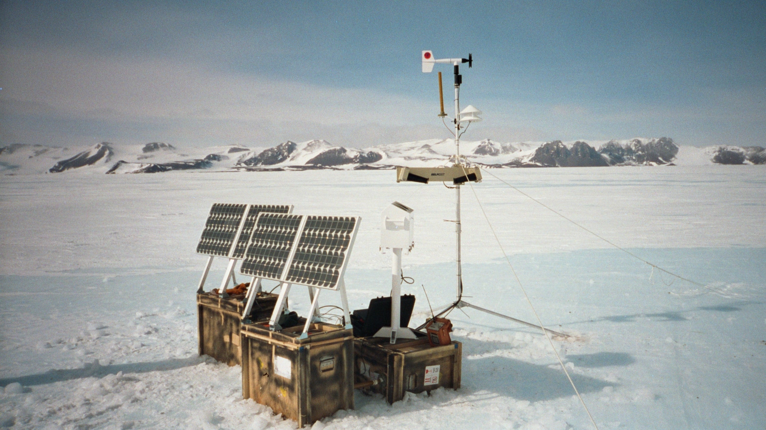


1 Photo
Last updated: 2017-12-18 by SSEC Webmaster NSF USAP SSEC