Turns out I can’t keep up the blog-a-day pace! The past few days have brought progress, and our first weather delays!
Since a common theme with my first two blog posts was the warmth in McMurdo, I will lead this one off by saying that it’s a cool 19 F right now, with a wind chill of 6 F. This is more like it! Though it’s definitely not unbearably cold.
Today marks my last day of training. I have to take the snowmobile refresher course this afternoon, and once that is done I will be free to do any and all fieldwork we need to do this season. The past few days I completed Crary lab safety training (Crary is the building that we work in) as well as training on how to walk and hike around McMurdo (called the Outdoor Safety Lecture). The latter training seems mundane and intuitive, but there are certain areas that are very dangerous and potentially life-threatening if you don’t follow some simple guidelines…
The different hikes can be split up in their degree of danger by whether you need to take a buddy with you, fill out an “eFoot Plan,” or do the walk whenever you please. Walking to Hut Point is probably the easiest hike to do and falls into the last category. Lee, Melissa and I were able to do this walk without taking the Outdoor Safety Lecture because the level of danger is so low.
For other hikes, you need to fill out an eFoot Plan due to their length, difficulty and danger, or all of the above. This eFoot Plan lets the Firehouse in McMurdo know when you plan on leaving town and returning. If you do not return to town on time, they will assume the worst and start the search-party process. One of the longest hikes you can do is to Castle Rock. It can take up to 8 hours to complete the full Castle Rock loop, but you can also just walk to Castle Rock and back and cut that time in half. The full loop sees you walk on Ross Island to Castle Rock, then down to the ice shelf to complete the loop back into McMurdo. Perhaps the most dangerous part of this loop is on the ice sheet, because there are crevasses that are near the trail. If you veer off the flagged trail too far, you may encounter crevasses that can be fatal. The Outdoor Safety Lecture goes over these dangers, which is why it is important to attend it. But one needn’t worry too much about these crevasses; the flagged trails are safe to walk on, and as long as you don’t wander, you will be fine. Another danger about these longer hikes is the weather. It can change very quickly down here. Due to blowing snow and fog, whiteout conditions can be attained quickly. If you can see the weather turning bad, it’d probably be best to get back to town as quickly as possible.
If you’re careful and take into account all the hazards, these hikes can be very rewarding (this of course is an assumption on my part, as I haven’t done them all, but judging by the pictures, they look to be worth it). I hope to do the Castle Rock loop later while I’m down.
Ok where was I… Let’s talk about Pegasus AWS and driving out there. Lee and I took a shuttle van out to Pegasus Airfield on Tuesday 7 January (this is also where our plane landed on the ice). It’s about 15 miles from McMurdo but takes an hour or longer to get there. We need to take a shuttle van, or Ivan the Terrabus, or a Delta, and the maximum speeds these vehicles can go on the snow roads is around 20 mph. If they go too fast, their tires will tear up the roads and make it even more difficult to drive on. The warm temperatures also lead to a degradation of the roads. This means it’s sloowww-going.
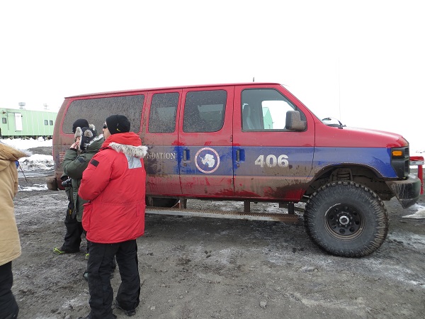
A shuttle van (picture taken 2012)
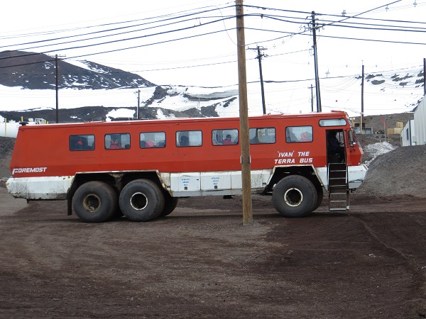
Ivan the Terrabus (picture taken 2012)
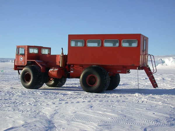
The Delta (not my picture, I got it from http://asd.gsfc.nasa.gov/archive/tiger/images/delta.jpg )
We wanted to go to Pegasus AWS to realign the freewave antenna to reach T-site near McMurdo. When we arrived, the first thing we noticed was how much snow-melt had occurred at the base of the station. It was very concerning, as it loosened the guy chains which could cause the tower to fall over. This happened earlier this week to an AWS, belonging to a different group, out at the airfield. We hope ours doesn’t suffer the same fate.
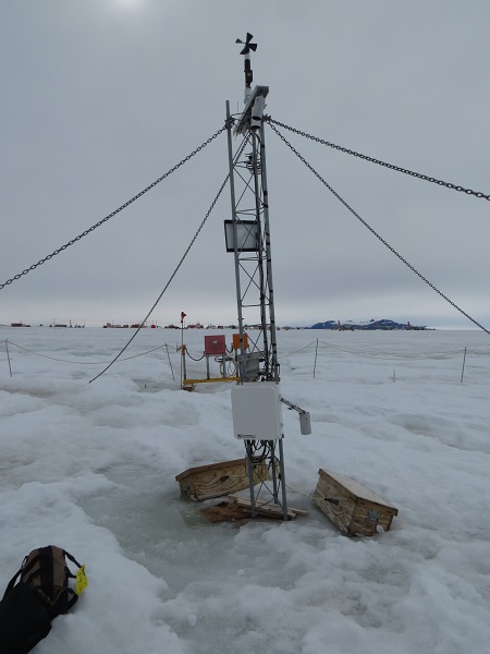
Pegasus AWS upon arrival. The darker area at the base of the station to the left has standing water. Yikes!
We were at the site for longer than planned, trying to diagnose why the transmissions weren’t working properly. Unfortunately, we couldn’t fix the problem in the field and decided to head back to McMurdo and discuss our options. We will be heading out to Pegasus the next chance we get. One silver lining to our extended work at Pegasus that day was that we stayed long enough to see the LC-130 that John Cassano was on land at the airfield. Although Lee and I didn’t meet up with John at the airfield, it was cool to see that his plane landed safe and sound.
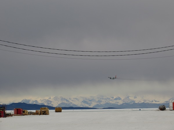
At Pegasus Airfield watching the LC-130, with John Cassano on board, land
Finally, to satisfy the requirement of talking about planes in this post, as the title calls for, Lee and I were hoping to fly out to Alexander Tall Tower! AWS today to do some instrument raises and dig out the power system, with the help of the riggers. We were going to take a Twin Otter, a fixed-wing aircraft, but weather has delayed the arrival of the otter into town, and as such our trip to Tall Tower! was cancelled. It wasn’t absolutely necessary for us to go out there today, as hopefully later in the season it can be completed.
If you want to learn even more about John and Melissa’s experience at Tall Tower!, you can follow their blogs here:
John Cassano’s blog:
http://cires.colorado.edu/blogs/antarcticuavs/
Melissa Nigro’s blog:
http://melissaontheice.blogspot.com/
And both of these blogs are linked on our website at:
http://amrc.ssec.wisc.edu/outreach/
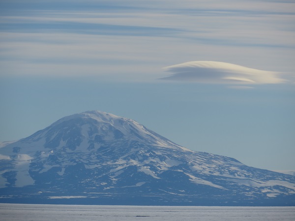
I’ll close with a few pictures of some cool clouds I’ve seen since being here. The geography of the area, with the mountains and ice shelves, allow for some unique cloud formations and favorable cloud viewing.
Lenticular clouds at Mt Discovery

Layers of lenticular clouds over the Royal Society Range, which is across the McMurdo Ice Shelf from McMurdo
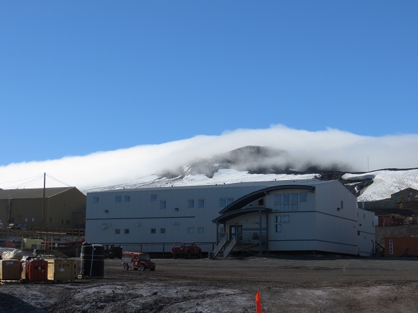
Fog rolling over the hills to the north of McMurdo. Taken from just outside our lab at Crary
Cheers!
Dave