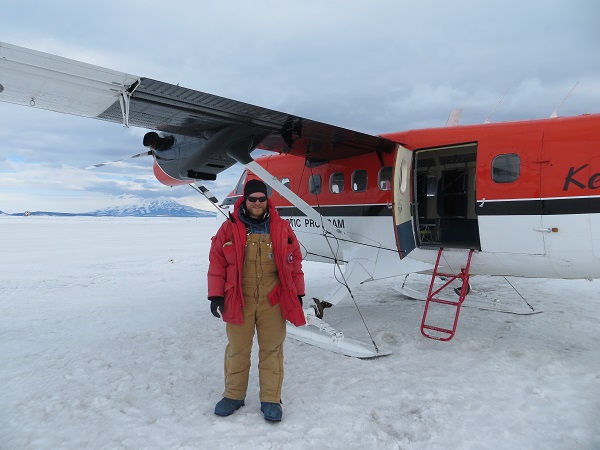
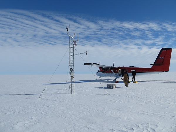
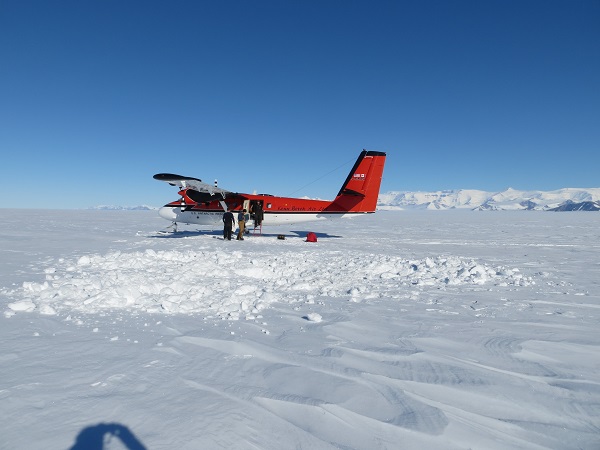
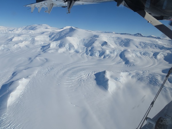
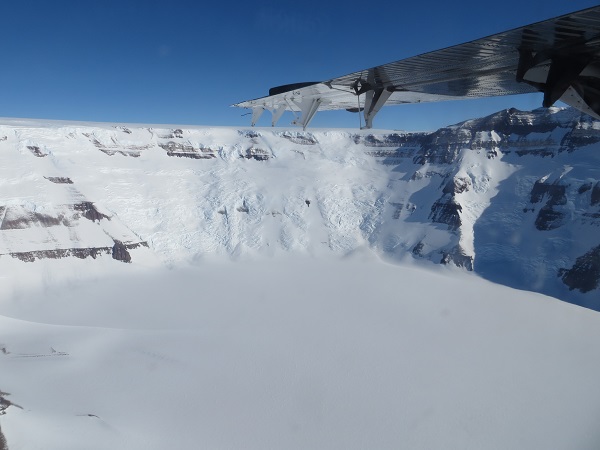
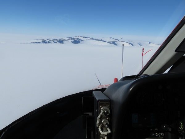
On Tuesday 28 January Lee, myself, and two riggers (Andrew and Emily) did something that I thought only happened in fairy tales. We took a Twin Otter out to Alexander Tall Tower! AWS. Now, an Otter had already been out there to pick up Ben the Kiwi. No way, I thought, was there a chance that the weather would cooperate enough to get us out there a second time in the same season. Sure enough…..
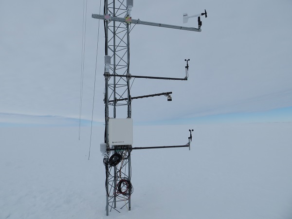
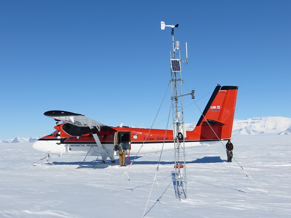
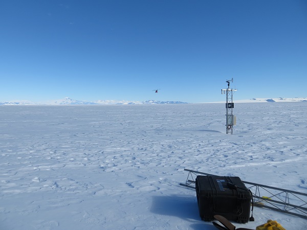
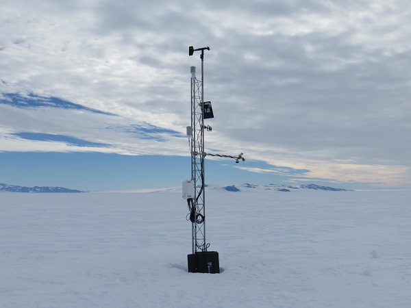
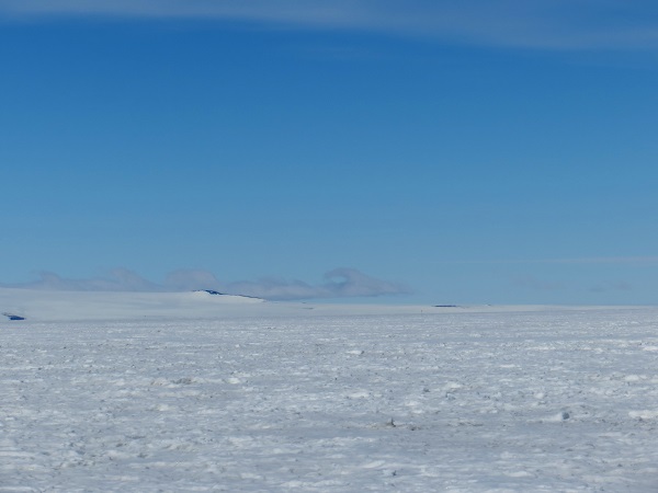
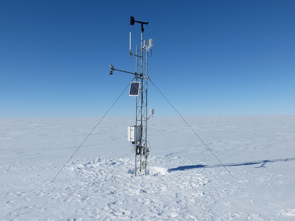
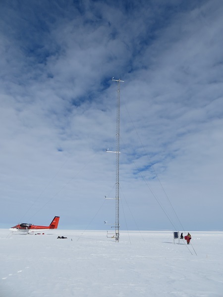 The much talked about, seldom visited Alexander Tall Tower! Our goal was to have the riggers raise the lowest three levels of instrumentation, while Lee and I would raise the power system by digging it out and reinstalling it back on the surface. You may be thinking, “Why do the instruments need raising? It’s a tall tower (100 feet at initial install, now about 90 feet) so the instruments must be high enough from the surface.” You would be partly correct. There are 6 levels of instrumentation. Referring to the picture above, each of the horizontal bars is a level of instrumentation. The top three are pretty high above the surface, but the bottom three are bunched near the surface and are at a higher risk of getting buried. The riggers did a great job raising these, saving them from the wispy grasp of blowing snow for at least another year.
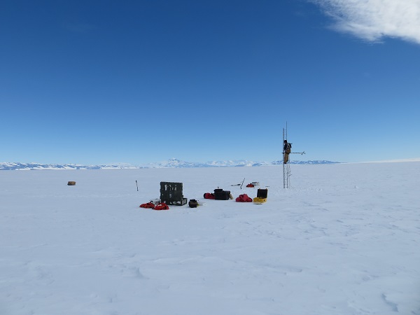
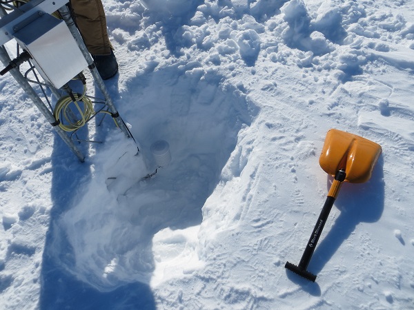
 The lowest three levels of instrumentation, after being raised Lee and I had our work cut out for us. The power station was installed three years ago, and hadn’t been raised since. There is about 1.5 feet of snow accumulation each year at Tall Tower!, so the bottom of the station was 4.5 feet deep plus the amount it was buried upon installation, which could have been a few feet. We needed to dig 8 feet down!
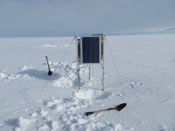 The power system. We had already started digging a bit. The things we needed to dig out:
The solar panel framework
Three guy wires with deadmen anchors
Battery box
Cable connecting the power system to the tower
Our first plan of attack was to dig out the battery box(es). We weren’t sure whether there were one or two. The top few feet of snow was fairly powdery and easy to shovel. After that layer, the snow became more compacted. The tricky part was around 5 or 6 feet down, when we ran into a layer of ice.
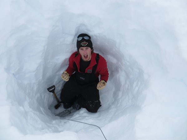
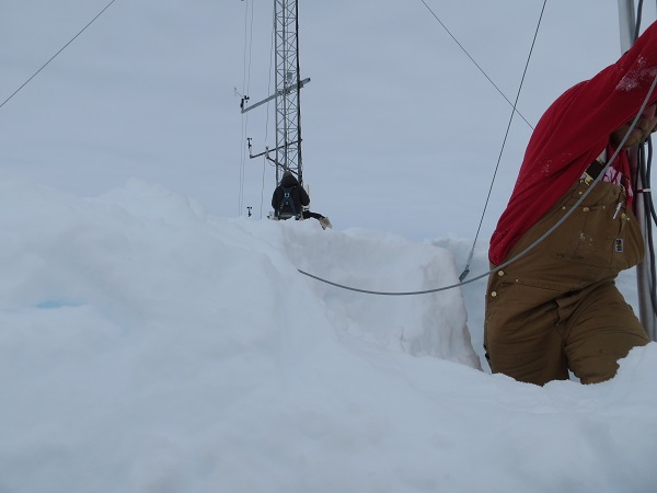 Eye-level view from the first pit I dug. The surface is at Lee’s waist. Shortly after we started digging, I decided to go for one of the deadmen while Lee continued to reach the battery box(es). The deeper I dug, the more the “digging” became stabbing to break up the hard snow and ice, the pieces of which I would shovel out. It became exhausting. The guy wire never seemed to end, and when it seemed as though I would never reach the deadman, I struck metal. The relief was short-lived, as there was even more ice built up around the deadman, and its length (about 2 feet) was greater than I anticipated. It’s difficult to describe how good it felt to finally break it loose.
 Yes! I had gotten two of the guy wires and deadmen out, and Lee was still digging for the battery box(es) and the third guy wire, when we had a conference with everyone to determine whether it was reasonable for us to try to dig out the whole power system. We decided it wasn’t; there was far to much digging to do. Given John and Melissa’s success snowmobiling to the site, it helped make our decision to hold off with the power system raise until next season. We can set up a 3-day camp then and complete the rest of the digging. Before we left, I wanted to make sure we got all of the deadmen out.
 The power system, with all three deadmen dug out Lee pulled out the last deadman from the pit, and the way in which he did it couldn’t have been better. I had chiseled it out from the ice and snow, and it just needed a good hard yank or two to get out. Lee was holding the guy wire and was standing at the top of the pit, yanking away. I was watching as I saw it coming looser and looser. On the last yank, Lee had tugged so hard that he lost his balance and fell backward…..into the first pit I had dug. The riggers were watching and instantly burst out laughing, as at one moment they saw Lee and the next he was out of sight. Fortunately, he wasn’t hurt. We had filled up the hole about halfway with some chunks of snow that we had dug out from other holes. It was a funny way to say so long to Tall Tower!, until next year.
Cheers!
Dave
The busy-ness (ha!) continues. Our days have been filled with work this week, which is always welcome down here. Things can get boring pretty quickly if there isn’t any work to do. I’m squeezing in this blog post so I can keep up with the work that we’ve been doing. If I wait too much longer, this information will be too old to post!
This past Monday, 27 January (Lee and I both agree that that feels WAY longer than 2 days ago), we flew by helo to Ferrell (install freewave transmission) and Lorne AWS (station check up). It was a relatively easy day for fieldwork.
We arrived at Ferrell, and the first thing we needed to do was install the freewave antenna.
 Lee getting the freewave antenna ready to be installed. That small tower section on the far left is the old Ferrell AWS. When installing the antenna, we needed to make sure it was angled slightly away from the surface so it could hit White Island AWS. Ferrell AWS was beginning to lean, so mounting the antenna with a normal bracket caused the antenna to point into the ground. We brought a bracket in which we could angle the antenna correctly and got it installed.
 Ferrell AWS upon completion. Notice the angled black antenna on the right of the station. We verified the freewave transmissions were working and hopped on the helo to go check on Lorne AWS (the helo stayed on site with us as we did our work).
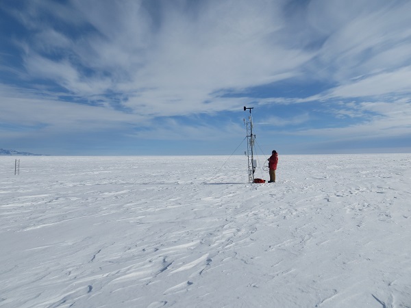
We were unsure whether Lorne AWS needed to be raised or not. To our delight, the station height looked good, so all we really needed to do was remeasure the instrument heights.
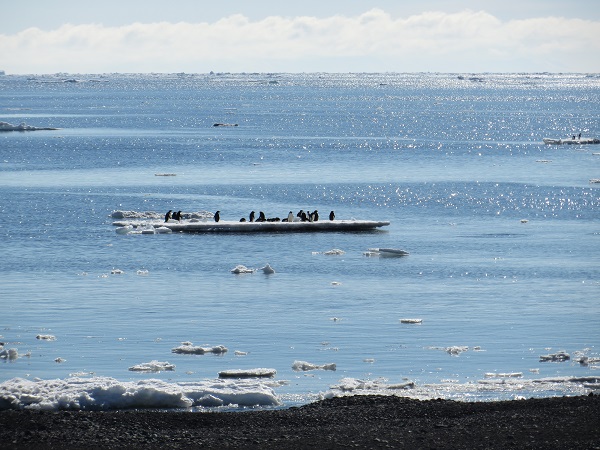
 Lorne AWS, with Lee and our helo pilot Ryan on the left. Once that work was done, we could head back to McMurdo. Piece of cake! One advantage to doing helo trips is they’re (inherently) quicker than Otter trips, so it doesn’t take an entire day to do a couple stations’ work. On Monday, we left McMurdo at around 9:15 am and returned around 3 pm. When we did return, we spotted some welcome visitors on some ice offshore!
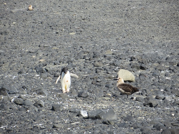
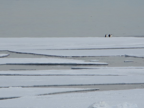 Some Adelie penguins hanging out on broken sea ice. A digression: Good news arrived to McMurdo the night prior (Sunday 26 January) in the form of John, Melissa and Suz (if you’re keeping track at home, Ben the Kiwi had already made it back to town a few days sooner than the rest)! They returned from their 12-day camping trip out at Tall Tower! AWS, and they were all in good spirits. Based on their experience, it seems like snowmobiling out to Tall Tower!, rather than taking the Twin Otter, is the way to go; it’s much more reliable, as we would be able to depart practically whenever we wanted because we wouldn’t be hindered nearly as much by the weather. As far as John and Melissa’s science work is concerned, they were able to get it all completed successfully. An overall great trip for them!
Back to the original subject: With Monday being a success, our work with helo travel was completed. It’s all Otters for us from here on out (except a snowmobile trip or two). Lee and I flew by Otter yesterday and today, and I’ll reserve those fun stories for the next couple blogs.
Cheers!
Dave
It’s been another busy week as we visited more AWS. On Wednesday 22 January and Thursday 23 January Lee and I flew by Twin Otter fixed wing aicraft to Lettau AWS, on Wednesday, and Tom AWS, on Thursday. Wednesday was my first flight on a Twin Otter, so I was eager to get flying. But, of course, it’s not as simple as hopping on the plane and leaving.
There is more time and preparation that goes into flying by Otter than by helo. All the cargo, aside from the literal passengers and some small bags, needs to be entered into the cargo system. Then, as opposed to departing right from McMurdo as you do with helo, the Otter departs from Pegasus airfield. The cargo needs to be ready out there when we want to fly, so we need to enter it into the system at least 2 days before we fly. We find out if we’re on the schedule to fly the night before flight date. Around 7 am the following morning we get a call from fixed wing ops whether we are a go or we have been canceled. If we’re a go, we need to catch the shuttle out to Pegasus, which leaves McMurdo at 8 am. The time between the call and the shuttle can get hectic. That shuttle ride is about an hour, and it takes about an hour to prepare the Otter for flying (loading cargo, fueling up, etc). And finally, inherent in Otter flights is that the travel time to AWS is almost always longer than helo because we only use the Otter for AWS that are too far away for the helo to reach. I’ve now discovered that all these factors add up to very long work days when flying by Otter.
 Lee and the Otter, preparing to depart Pegasus The flight to Lettau took 2 and a half hours. It’s a great time for reading, taking a nap, or enjoying the sights.
Length aside, it’s always great to get to AWS, especially when we get one working again like we did at Lettau. Our goal was just what we accomplished: install the enclosure and get the station transmitting again via Argos. All the instrumentation was already on the tower. The only additional thing we needed to do was raise the lower temperature sensor about a foot. There isn’t usually much accumulation there, so that usually makes servicing easier.
 Arrival at Lettau AWS 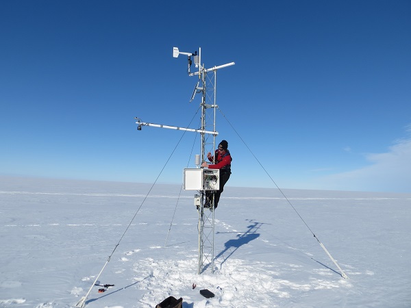 Me, securing the enclosure 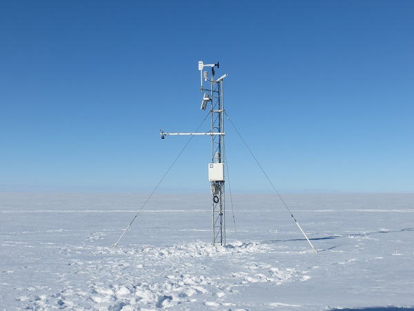 Lettau AWS upon completion On Thursday, we flew to Tom AWS. We had ambitious goals for this day; we wanted to remove Tom and reinstall it at a location nearby, but far enough away to measure data unique to the original location of Tom. This flight took just over 3 hours, and considering how long it usually takes to remove and install an AWS, our plans had us pushing right up against the Otter pilots’ duty days (the number of hours they can work in a day; I think it’s around 14 hours).
We arrived to Tom AWS at 1 pm and got to work right away. This was a full removal, so we needed to dig out the tower section, batteries, and the dead men attached to the guy wires.
 Arrival at Tom AWS There was more accumulation and many more layers of ice than we anticipated, so the removal took too long. It was the only thing we could do that day. We also had to cut our time there short because we needed to stop at a fuel cache along the way back to McMurdo to refuel. All four of us, myself, Lee and the two pilots, ended up digging the station out. Each of the holes (4 total) ended up being about 5 feet deep. One consolation to the rapid and tiring work was that we successfully removed it all.
 Proof of the successful removal It was time to head back to McMurdo, first stopping at CTAM (the Transantarctic Mountains Field Camp) to refuel. The scenery was stunning. We flew along and over the mountains for the hour-long flight to CTAM.
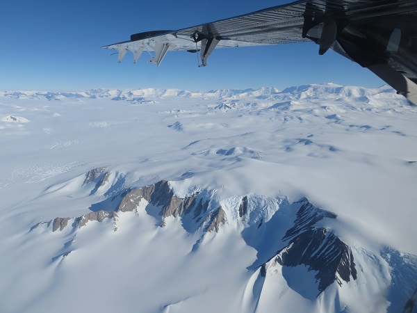 The Transantarctic Mountains 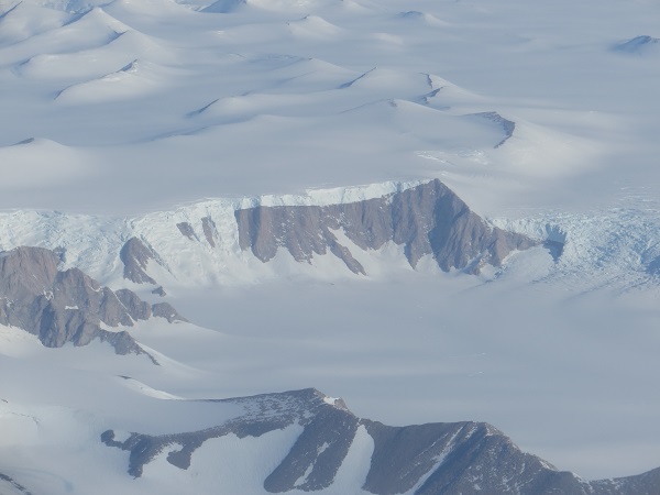
When we got back to McMurdo around 9:30 pm, we ate a late dinner (24-hour pizza, yes!) and then got some shut-eye.
Cheers!
Dave
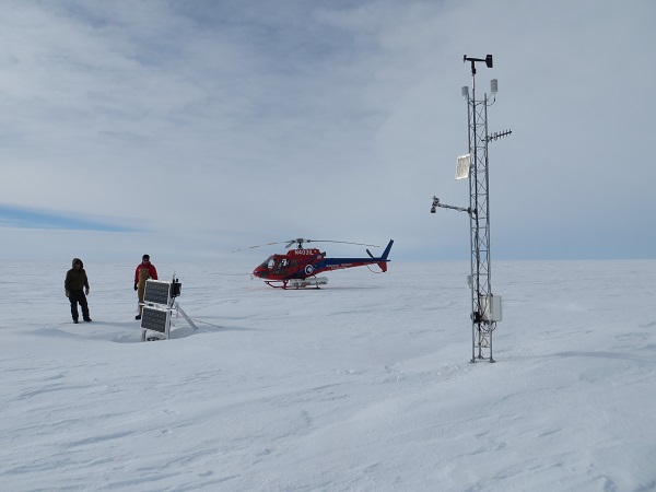
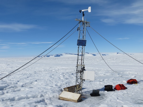
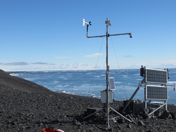
Lee and I knocked off another station on our to-do list when we flew by helo to Linda AWS yesterday, 20 January (I suppose you could consider this part of the helo bonanza). We needed to dig out and remove the old instrumentation, raise the station, and install new instrumentation. We also wanted to set up freewave transmission for it, but we were prepared to use Argos transmission if the freewave failed and we couldn’t connect to White Island. The weather was great, with clear skies at McMurdo. At Linda we were on the edge of some high clouds, and there was only a slight breeze… Excellent working conditions.
 The helo leaving us at Linda AWS Once they left, we got right to work. We set up our GPS instrument to get the coordinates for the site, then started digging. We needed to remove a couple of buried instruments, a lower temperature sensor and a junction box. This proved slightly more difficult than we first anticipated due to a layer of ice that had formed around the instruments. Once we recovered those, we could free up the cables for the removal of the rest of the instrumentation. The next order of business was to install the 7-foot tower section. Once that was installed, we put up the new instrumentation.
 Our working area, with Lee on the tower installing instruments The high clouds started slowly creeping overhead, so we were glad that once we got all of the instrumentation secured, we were able to connect right away to freewave. It was just about as painless an attempt as one could imagine!
 The completed Linda AWS The new instrumentation we installed are (from top to bottom) an anemometer, temperature sensor, solar panel, freewave antenna, relative humidity sensor, acoustic depth gauge (measures snow height), pyranometer (radiation sensor), an infrared sensor to get the snow surface temperature, the enclosure including a pressure sensor, and last but not least a battery box to power the station.
I’ll close this post with more penguin photos! These were taken Sunday night, 19 January. Some folks from POLENET, the science group we share an office with in Crary, said they saw 4 penguins on the ice near McMurdo. I got my camera and went down to be treated to many more than 4! I watched them for about an hour, and at one point one hopped on shore about 25 feet away from me.
 Adelie penguins. We saw them swim along the shore too! 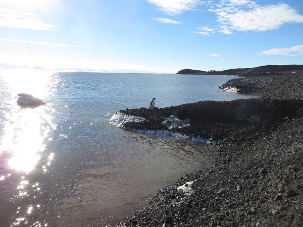 I had just sat down to view some penguins in the distance when this guy hopped up on shore 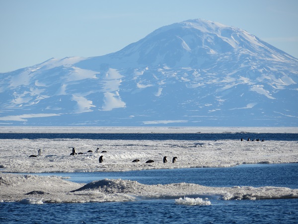 Adelies, with Mt Discovery as a backdrop Cheers!
Dave
And so continues the helo bonanza. On Thursday 16 January we were planning to helo out to Ferrell AWS to switch the data transmission from Argos to freewave. Of course, all of these flights depend on good weather, and Tuesday and Wednesday were beautiful days for flying. On Thursday, however, there were some low clouds apparent on the satellite imagery to the east of White Island, which is where Ferrell AWS is located. This didn’t bode well for a helo landing, as the surface becomes nearly impossible to define when there are low clouds over ice. Lee and I arrived at the helo pad, talked with the helo techs and decided that we would take the trip out there and determine whether it was safe to land upon arrival.
There were only high clouds in the McMurdo area, but a few minutes after we departed we started seeing the low clouds. They became thicker and more widespread as we approached Ferrell.
 Low clouds, as seen from the helo. The surface became completely obstructed from view the closer we got to Ferrell. The clouds did have a cool, hill-like appearance though. A few miles from Ferrell, we decided that it was unsafe to land so we turned around and headed for McMurdo. Over the intercom, Lee said to me that now we could go to Pegasus AWS and finish up work there, as we would have time to take a shuttle from McMurdo. The pilot and helo tech heard this and said, “Why don’t we just drop you off at Pegasus?” We said, “Why not!!”
Lee and I arrived to Pegasus in style. Most often, to get to Pegasus from McMurdo you would take a shuttle, and the drive can take an hour or more. It’s funny to think that Lee and I took a helo from McMurdo, to Ferrell, then to Pegasus in about the same amount of time as a shuttle ride to Pegasus.
It was very generous of the helo guys to drop us off. It saved us a lot of time and gave us a chance to eat our flight lunches in the Pegasus galley. Once well fed and rested, we headed out to our AWS to finalize the freewave transmissions there.
 Pegasus AWS, with White Island (where we are directing our transmissions) in the background As we were waiting to verify the transmissions were successful, I noticed a very cool cloud feature on the horizon near White Island. It’s called Kelvin-Helmholtz instability, and it occurs when there is a velocity and density difference across two layers. This can result in a wave-like cloud structure as it did for us that day.
 Kelvin-Helmholtz wave clouds Once we were done admiring that spectacle, we verified that the freewave transmissions worked at Pegasus. After several trips to the station, we finally diagnosed the problem and fixed it successfully. We then headed back to the airfield to catch a shuttle to McMurdo. On our short drive to the airfield, we were treated to the always-welcome sight of four penguins, seemingly on a journey somewhere.
 Four Adelie penguins at the airfield On Friday 17 January, we (continuing the helo bonanza) flew out to Ferrell AWS. This time, the weather cooperated. The skies were clear between McMurdo and Ferrell and beyond. The only very minor issue was the wind; it wasn’t too windy but it was constant as we worked. At Ferrell, we wanted to switch the data transmission to freewave. We also noticed that the lower temperature sensor was buried, so while Lee was fixing up the freewave antenna, I dug out the sensor to be raised.
 Ferrell’s lower temperature sensor Unfortunately, after trying to adjust the direction of the antenna and attempting to connect via the laptop, we could not establish a connection between Ferrell and White Island AWS. We will have to visit the station again; fortunately, the helo schedule is pretty open, so we are actually on the schedule to do this visit sometime next week. For now, Ferrell is still transmitting via Argos.
 Ferrell AWS after we did our work Today, Saturday 18 January, we were hoping to yet again continue the helo bonanza to Linda AWS, but we got canceled due to weather. It is far too windy (~60 mph winds at Black Island, which is on the way to Linda). Hopefully we can get there next week.
More updates as they come.
Cheers
Dave
On Wednesday 15 January, Lee and I continued our helo bonanza by flying to Cape Bird AWS. Just like Tuesday, the purpose of this trip was to check on the AWS and make sure things looked ok. Before flying to Cape Bird, there are a few important considerations the helo operations personnel have to consider.
Cape Bird is at the northern end of Ross Island, while McMurdo is at the southern end. The helo cannot fly over open water, so it either has to fly over land or ice. This is important to keep in mind, especially this time of year, because at Cape Bird the sea ice breaks up and melts, leaving open water in its wake. There are also a few areas on the island along the route that are no-fly zones, due to penguin rookeries. Ross Island becomes more narrow, and essentially becomes a peninsula, as you approach Cape Bird. Consequently, there is only a thin flight path. If there is enough cloud cover that makes it difficult to see land, this flight can become hazardous and unsafe to do. There are some cliffs at Cape Bird where the helo needs to land, so good visibility is essential. Luckily for us, the skies were mostly clear so we could fly to Cape Bird with ease. The helo pilot even asked me to take some pictures of the area where the flying becomes precarious as he took waypoints to document the surface features.
 View of part of the “precarious area” on our way to Cape Bird. This is looking back toward McMurdo. You can see the elevation is steep along the coast, and there is plenty of open water. Mt Erebus is out of view but to the front left. 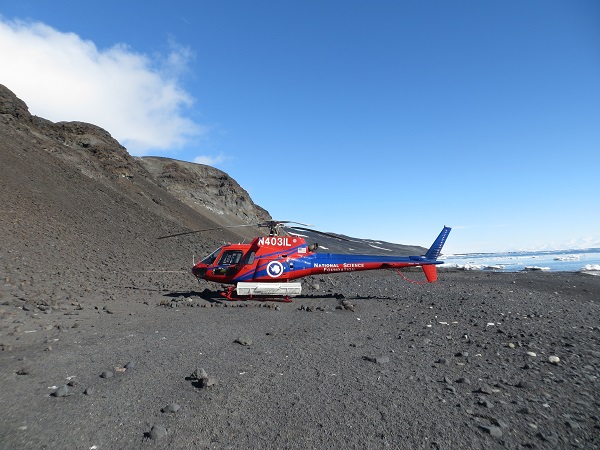 A successful landing at Cape Bird. Note the cliffs A huge bonus about coming to Cape Bird is that there is an Adelie penguin rookery there. So I got to see more penguins! There were some roaming on the beach, and we could see lots in the water swimming and jumping into and out of the water, or standing on icebergs. They looked like they were having fun out there!
 Penguins hanging out on a berg We said hello to some of the Kiwis (New Zealanders) who are stationed at the Kiwi Base there at Cape Bird, then walked up the somewhat steep hill to check on our AWS. Lee and I were anticipating a quick look-around and our work there would be done, but that was an optimistic expectation. At first glance it looked to be ok, but upon closer inspection we noticed the propeller on the anemometer had come completely off, the temperature sensor was missing its radiation shield, and one wing on a wind turbine for Lars Kalnajs’ ozone detection system had broken off.
 Cape Bird AWS upon arrival. Lars’ instrumentation is on the right Right before we departed McMurdo, Lee had the brilliant idea to bring a spare nose cone and propeller for the anemometer, just in case. Turns out we needed it! We got to work on installing that to the anemometer and searched for the missing parts. I stumbled across the broken propeller (it was about 15 feet from the station), but couldn’t find a trace of the radiation shield or broken piece from the wind turbine. We think that high winds picked up some rocks and caused this damage to the station, perhaps taking out all of the broken pieces in one fell swoop, or maybe there were two or three separate instances. There was a fair bit of corrosion on the station due to the sea, but despite these defects we verified that the AWS is still recording and transmitting measurements. The wind speed and direction are back on as well.
 Cape Bird AWS after we fixed what we could We will need to visit this station again to install a new radiation shield for the temperature sensor. Until then, the temperatures it records will be invalid as the sun can shine directly on the sensor, heating it up so the temperature it records is no longer a measurement of the air. The relative humidity sensor has a temperature sensor in it, used to calculate the relative humidity, so that should still be accurate and could be used if needed.
Throughout our visit, I was able to snap some pictures of the penguins and scenery. Here are a few that I took.
 An Adelie started walking towards me as I searched for the radiation shield, apparently with complete disregard for where it was going. This skua didn’t like how close the Adelie came to its chick (not pictured)  The Adelie penguin rookery  The Adelie Penguin Photoshoot  Adelies seem to enjoy the attention Cheers!
Dave
Tuesday 14 January was a traveling day for our group. John and Melissa (along with Ben Jolly, a grad student from the University of Canterbury Christchurch, New Zealand, and Suz, a mountaineer) departed McMurdo for Tall Tower! AWS by snowmobile in the morning, with the goal of reaching the site about 8 hours later. They will be camping out at Tall Tower! for two weeks using UAVs (Unmanned Aerial Vehicles) to take measurements of the boundary layer, the lowest part of the atmosphere where most of the sensible weather occurs. As such, they had to bring a LOT of cargo with them (4 snowmobiles hauling ~1200 lbs of cargo each). Hopefully they made it there in a reasonable amount of time!
Lee and I did some traveling by helicopter yesterday. We flew to our AWS at White Island, Minna Bluff, and Marble Point. The purpose of this trip was to do station check-ups at each of the AWS, and there was nothing but good news; all of the stations looked fine, with only some very minor kinks.
Flying from AWS to AWS, we saw some awesome scenery. To top it off, I got to ride in the front of the helo, giving me a great vantage point of the sights. I’ll let the pictures (and associated captions) do the rest of the talking for this post.
 Sitting in the front, on the way to White Island (pictured) 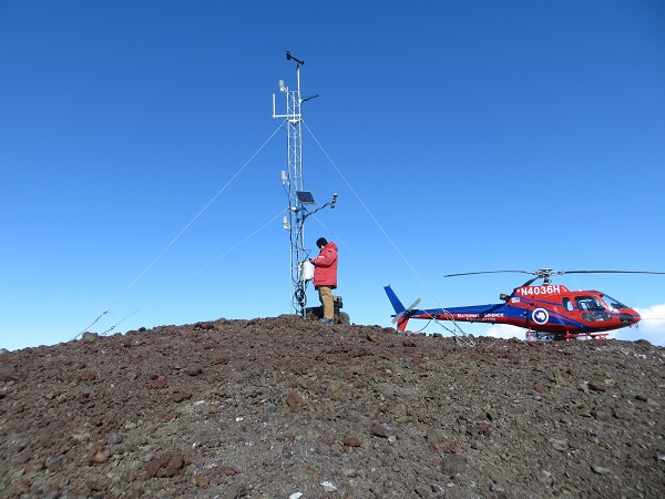 White Island AWS, Lee, and the helo  At Minna Bluff. It was majestic flying over the cliffs 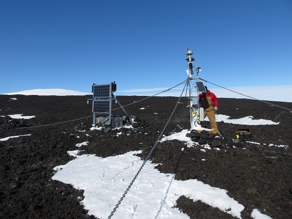 Minna Bluff AWS 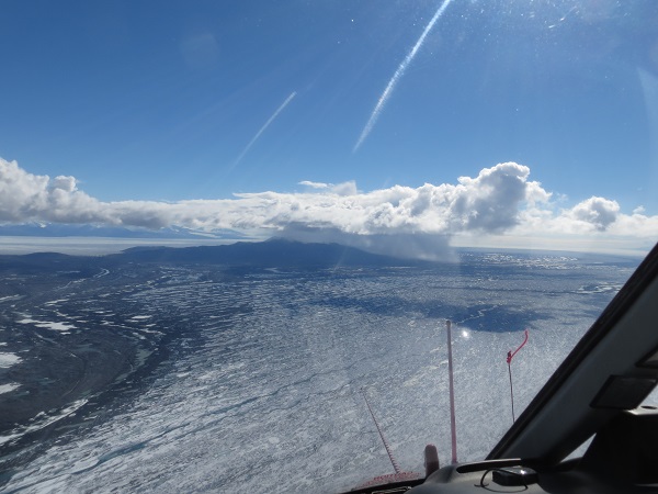 Flying from Minna Bluff to Marble Point, we saw an isolated snow shower over Brown Peninsula  The sheets of precipitation  The distinction between land and blue ice is stark  Marble Point I AWS 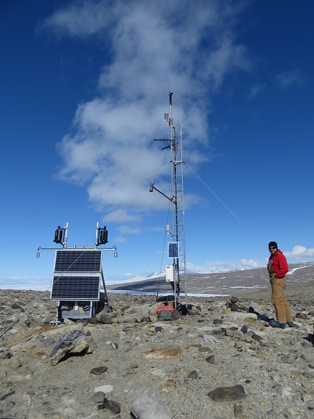 Marble Point II AWS 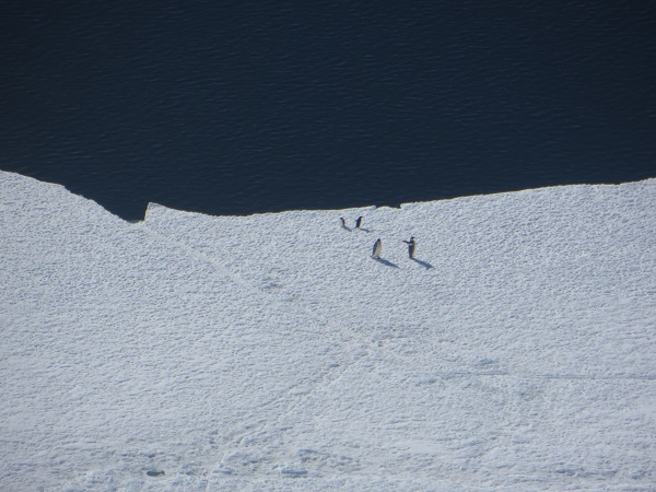 On our way back to McMurdo we saw about a dozen penguins and half as many whales! Cheers
Dave
It’s a good thing I posted my previous blog post when I did, because had I waited until after the snowmobile training that day, the only thing I would have talked about was the penguin we saw…..
When John came in on Tuesday, he said he had seen a penguin near the transition off of Pegasus road. At the snowmobile training this past Friday 10 January (Lee, Melissa, John, and I all went), our instructor said that when we go out for a ride on our snowmobiles, we may be able to see that very penguin, as it was along our route. One may think, surely the penguin would have been long gone three days after someone had seen it; it could be on the other side of the continent! But not so (in this case, anyway); this penguin was molting, and during that process the feathers aren’t waterproof and it needs to stay out of the water. Therefore, it might as well set up shop on the surface and stay there as long as it can, until the molting process is complete.
We completed the overview of the snowmobile’s parts, functions, and maintenance, then headed out to the transition to go for a ride. We all got on our snowmobiles and took off. The penguin was a couple miles from the transition, so as we drove on Pegasus road towards our makeshift obstacle course we looked for any black spec that may or may not be a penguin. Alas, we were unsuccessful in spotting it on the way out. We enjoyed our obstacle course and headed back to town. This time, we looked much more carefully and…..
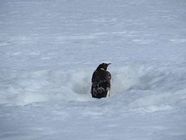 The Emperor penguin! I was at the back of the pack of snowmobiles, so when we started slowing down I figured someone had spotted the penguin, though I couldn’t see it right away. I tried hard to contain my excitement and not jump off the snowmobile and run towards the penguin, thereby scaring it away. As we approached to start the picture-taking frenzy, it looked to be about 40 feet away. Lee and Melissa said they had never been this close to one. Me neither.
You can clearly see that this penguin is molting, as indicated by the grayed feathers on its back. This molting process lasts about 34 days for Emperor penguins, according to Wikipedia.
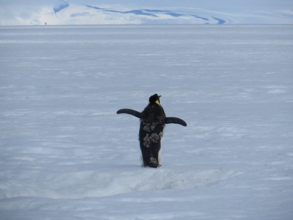 Stretching its wings 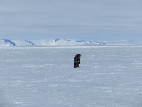 The Emperor with White Island in the background 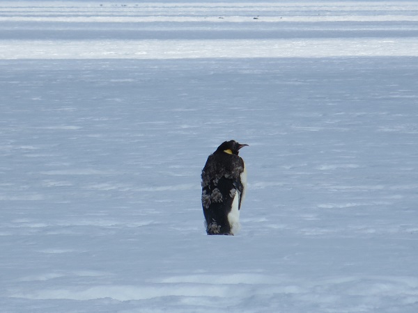 A good profile shot We spent about 5 minutes looking at the penguin, then we headed back to McMurdo. I could have stayed for another hour. I hope to see many more penguins, but if not, I’ll be happy with this first sighting!
Cheers
Dave
Turns out I can’t keep up the blog-a-day pace! The past few days have brought progress, and our first weather delays!
Since a common theme with my first two blog posts was the warmth in McMurdo, I will lead this one off by saying that it’s a cool 19 F right now, with a wind chill of 6 F. This is more like it! Though it’s definitely not unbearably cold.
Today marks my last day of training. I have to take the snowmobile refresher course this afternoon, and once that is done I will be free to do any and all fieldwork we need to do this season. The past few days I completed Crary lab safety training (Crary is the building that we work in) as well as training on how to walk and hike around McMurdo (called the Outdoor Safety Lecture). The latter training seems mundane and intuitive, but there are certain areas that are very dangerous and potentially life-threatening if you don’t follow some simple guidelines…
The different hikes can be split up in their degree of danger by whether you need to take a buddy with you, fill out an “eFoot Plan,” or do the walk whenever you please. Walking to Hut Point is probably the easiest hike to do and falls into the last category. Lee, Melissa and I were able to do this walk without taking the Outdoor Safety Lecture because the level of danger is so low.
For other hikes, you need to fill out an eFoot Plan due to their length, difficulty and danger, or all of the above. This eFoot Plan lets the Firehouse in McMurdo know when you plan on leaving town and returning. If you do not return to town on time, they will assume the worst and start the search-party process. One of the longest hikes you can do is to Castle Rock. It can take up to 8 hours to complete the full Castle Rock loop, but you can also just walk to Castle Rock and back and cut that time in half. The full loop sees you walk on Ross Island to Castle Rock, then down to the ice shelf to complete the loop back into McMurdo. Perhaps the most dangerous part of this loop is on the ice sheet, because there are crevasses that are near the trail. If you veer off the flagged trail too far, you may encounter crevasses that can be fatal. The Outdoor Safety Lecture goes over these dangers, which is why it is important to attend it. But one needn’t worry too much about these crevasses; the flagged trails are safe to walk on, and as long as you don’t wander, you will be fine. Another danger about these longer hikes is the weather. It can change very quickly down here. Due to blowing snow and fog, whiteout conditions can be attained quickly. If you can see the weather turning bad, it’d probably be best to get back to town as quickly as possible.
If you’re careful and take into account all the hazards, these hikes can be very rewarding (this of course is an assumption on my part, as I haven’t done them all, but judging by the pictures, they look to be worth it). I hope to do the Castle Rock loop later while I’m down.
Ok where was I… Let’s talk about Pegasus AWS and driving out there. Lee and I took a shuttle van out to Pegasus Airfield on Tuesday 7 January (this is also where our plane landed on the ice). It’s about 15 miles from McMurdo but takes an hour or longer to get there. We need to take a shuttle van, or Ivan the Terrabus, or a Delta, and the maximum speeds these vehicles can go on the snow roads is around 20 mph. If they go too fast, their tires will tear up the roads and make it even more difficult to drive on. The warm temperatures also lead to a degradation of the roads. This means it’s sloowww-going.
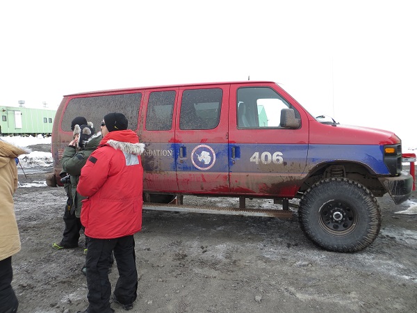 A shuttle van (picture taken 2012) 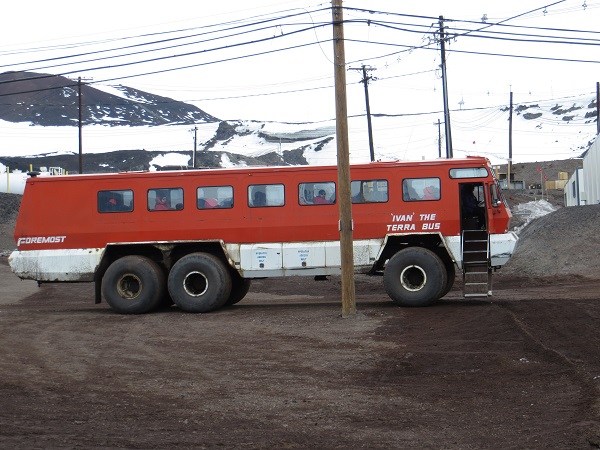 Ivan the Terrabus (picture taken 2012)  The Delta (not my picture, I got it from http://asd.gsfc.nasa.gov/archive/tiger/images/delta.jpg ) We wanted to go to Pegasus AWS to realign the freewave antenna to reach T-site near McMurdo. When we arrived, the first thing we noticed was how much snow-melt had occurred at the base of the station. It was very concerning, as it loosened the guy chains which could cause the tower to fall over. This happened earlier this week to an AWS, belonging to a different group, out at the airfield. We hope ours doesn’t suffer the same fate.
 Pegasus AWS upon arrival. The darker area at the base of the station to the left has standing water. Yikes! We were at the site for longer than planned, trying to diagnose why the transmissions weren’t working properly. Unfortunately, we couldn’t fix the problem in the field and decided to head back to McMurdo and discuss our options. We will be heading out to Pegasus the next chance we get. One silver lining to our extended work at Pegasus that day was that we stayed long enough to see the LC-130 that John Cassano was on land at the airfield. Although Lee and I didn’t meet up with John at the airfield, it was cool to see that his plane landed safe and sound.
 At Pegasus Airfield watching the LC-130, with John Cassano on board, land Finally, to satisfy the requirement of talking about planes in this post, as the title calls for, Lee and I were hoping to fly out to Alexander Tall Tower! AWS today to do some instrument raises and dig out the power system, with the help of the riggers. We were going to take a Twin Otter, a fixed-wing aircraft, but weather has delayed the arrival of the otter into town, and as such our trip to Tall Tower! was cancelled. It wasn’t absolutely necessary for us to go out there today, as hopefully later in the season it can be completed.
If you want to learn even more about John and Melissa’s experience at Tall Tower!, you can follow their blogs here:
John Cassano’s blog:
http://cires.colorado.edu/blogs/antarcticuavs/
Melissa Nigro’s blog:
http://melissaontheice.blogspot.com/
And both of these blogs are linked on our website at:
http://amrc.ssec.wisc.edu/outreach/
I’ll close with a few pictures of some cool clouds I’ve seen since being here. The geography of the area, with the mountains and ice shelves, allow for some unique cloud formations and favorable cloud viewing.
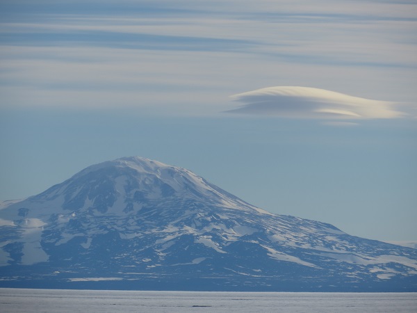 Lenticular clouds at Mt Discovery  Layers of lenticular clouds over the Royal Society Range, which is across the McMurdo Ice Shelf from McMurdo 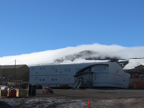 Fog rolling over the hills to the north of McMurdo. Taken from just outside our lab at Crary Cheers!
Dave
Two blog posts in two days! This has to be a record. Not sure if I can keep up this pace…
I realized that I wanted, but forgot, to include a picture in my first post, one that shows all the cold weather gear I was issued for this year. It gives a good idea of what we need to wear when doing field work.
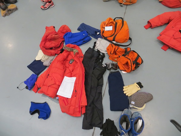 The Emergency Cold Weather gear I took to the ice, issued at the Clothing Distribution Center in Christchurch, New Zealand You can see that we get plenty of clothing to keep us warm in the harshest of conditions. Wearing all of this around McMurdo may be overkill right now, however and as you’ll see in pictures below, since it’s so warm here. The high at McMurdo yesterday, 5 January, was 42.8 F, and it’s supposed to be just as warm on the 7th. It’s 41 F as I’m writing this. It’s incredible how warm it is! This January has been warmer than average so far. It will be interesting to see how long this will continue.
Given this warmth, and a nice sunny day yesterday, Melissa, Lee and I took a walk out to Hut Point before dinner. Last year I came to the ice in December (which is on average colder than January) so I was excited to see the open water around Hut Point. I was amazed at how much open water there was! This bodes well for my attempt at sighting my first penguin in Antarctica.
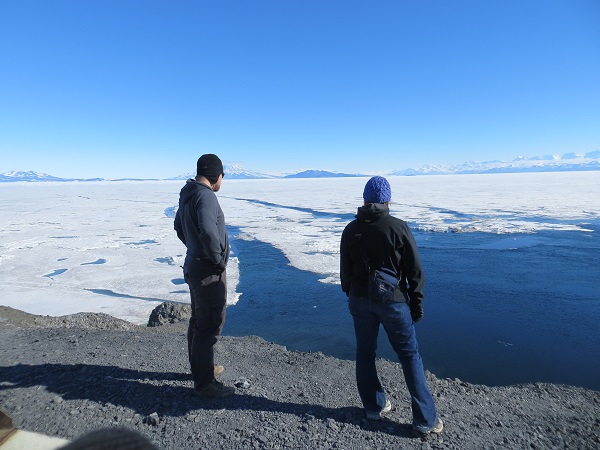 Lee and Melissa (undoubtedly sharing my amazement for the open water) at Hut Point 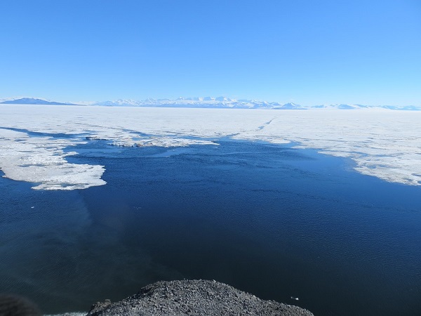 Open water at Hut Point 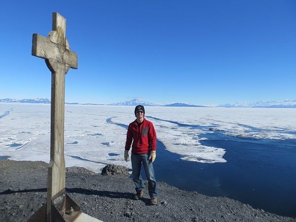 Me and the open water at Hut Point  The open water continues. Can you spot the skua? Today, the three of us agreed that we were smart to take advantage of yesterday’s good weather and go to Hut Point. There has been more cloud cover, though not complete sky coverage, today. Simply not as aesthetically pleasing, but it has still managed to get plenty warm. Melissa and I began our onslaught of trainings this morning with the Antarctic Field Safety Refresher training. We went over important things to consider when planning and conducting field work, medical issues that result from being in the cold such as hypothermia and frostbite, reviewing how to pitch and secure tents, and reviewing helicopter transportation. This is important for both of us, as we will be going out into the field. It was good to relearn some of the things that had become fuzzy in my mind after a year’s break. After that training session, Lee, Melissa and I talked with some groups about our upcoming travel plans for our work.
By the end of this week, we all should be done with our training and ready to tackle the field work.
I hope all of you in the US are handling the cold snap like champs!
Dave
|
|